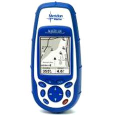
Product Profile of Global Positioning System Receiver with Mapping Database
Global Positioning System Receiver with Mapping Database finds your location by tracking up to 12 GPS satellites simultaneously and is accurate by three metres. The Global Positioning System Receiver has intuitive interface and large keyboard for direct access to the most accessed features. Hi-Tech Instruments supplies Global Positioning System Receiver with Mapping Database. Hi-Tech Instruments offers a wide range of products in the field of Surveying, Measuring, Monitoring, Mapping and GPS / GIS technologies. The Global Positioning System Receiver with Mapping Database has seven customizable graphic navigation displays to show a map, compass, speedometer, and text readouts of heading, bearing, speed, direction, ETA etc. The Global Positioning System Receiver is suitable for serious navigators and comes with 16 MB built-in mapping database including interstates, highways, city locations, airports, waterways, rivers, lakes, fixed nautical markers, buoys and lighthouses.
Key Features of Global Positioning System Receiver with Mapping Database
- 12 built-in coordinate systems and 76 datums including Latitude/Longitude, Universal Transverse Mercator, and Military Grid Reference System.
- Stores up to 20 routes, 500 waypoints and 2,000 track-points to easily find way back to favourite fishing spot or marine recreation local again and again.
- Save Track-to-Route feature allows to convert complicated track files into easy to follow routes
- NorthFinderTM technology shows direction even when standing still.
- Shows when the sun will rise and set, as well as the phase of the moon, for any date and location in the world.
- Fish and game calculator
- Allows to Monitor the GPS satellites in view and get information about their status
- Built to perform on the most challenging and rigorous adventure.
- Large backlit full-colour display
- Rugged construction
- Waterproof
- Built-in help database
- Multiple language support
Product Specification of Global Positioning System Receiver with Mapping Database
- Altitude:Up to 60,000 ft. (Operating)
- Antenna:Quadrifilar helix
- Battery:2 AA
- Battery Life:Up to 14 hours
- Display Resolution:120 x 160 pixels, grayscale
- Display Size:1.75" x 2.2" (w x h) (44.4mm x 55.9mm)
- Operation Temperature:14°F to 140°F / -10°C to 60°C
- Receiver:12 parallel channels, WAAS enabled
- Size:6.5" x 2.9" x 1.2" (h x w x d) (165 x 73.6 x 30.5 mm)
- Weight:8 OZ. (227 gram)
